Here's an interesting way of visualising part of the activity of a city: The Geotaggers' World Atlas by Eric Fisher. Eric has taken publicly available street maps of major cities, and overlaid them with traces of the locations from which people have taken geotagged photos. The result is a rather beautiful trace of the picture-taking activity through a city, which seems like a reasonable proxy for "where is open to the public and visually interesting".
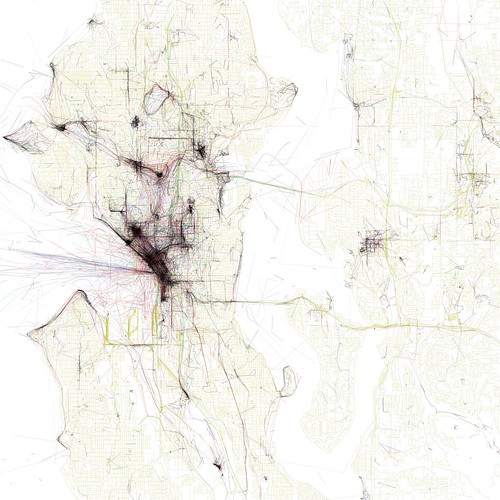
Looking at where is missing from these maps is also rather striking. For instance, Seattle has a river running through it, and that river is both an important industrial site and a tragic pollution dump. It's only a weak trace on the map because it isn't a scenic destination, but it's an important part of the story of Seattle. In the same way, in most of the mapped cities the majority of residences are off the photographed track. Looking at these maps, I'm painfully aware that in each of these cities that I have visited, excepting the two I've lived in (Seattle and London), I myself have barely left the heavily-tracked areas.
I don't have a huge point to make here, just that really knowing a city requires more than a tourist's-eye-view, because every city has important places that are not necessarily notable or tourist-inviting.

No comments:
Post a Comment